 |
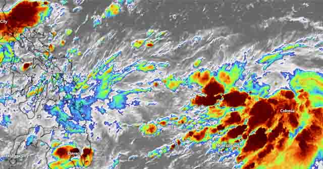
| PAGASA reported Tuesday that LPA's trough will bring rain to Eastern Visayas. It may become a tropical depression in 72 hours. (Photo: Satellite image via Windy) |
The trough of the low-pressure area (LPA) will bring rains over Palawan, Visayas (including Eastern Visayas), and Mindanao, according to the state weather bureau PAGASA on Tuesday.
At 3 p.m., the LPA was spotted 815 kilometers east of Eastern Visayas. It could develop into a tropical depression within 72 hours.
According to PAGASA's 4 p.m. bulletin, the shear line also affects Central Luzon.
Due to the shear line, cloudy skies with scattered rain showers and thunderstorms will prevail over Metro Manila, Central Luzon, Calabarzon, Bicol Region, Mindoro provinces, Marinduque, and Romblon.
The Northeast Monsoon will bring cloudy skies and rain to the Cordillera Administrative Region and Cagayan Valley (Amihan).
Due to moderate to heavy rains, PAGASA warned of the possibility of flash floods or landslides in these areas. Furthermore, the Amihan will cause partly cloudy to cloudy skies with isolated light rains in the Ilocos Region.
Wind speeds are expected to be moderate to strong in northern Luzon and the eastern sections of central and southern Luzon, while coastal water conditions will be moderate to rough, with heights ranging from 2.1 meters to 4.5 meters.
The rest of the country will experience light to moderate wind speeds and slight to moderate coastal water conditions, with waves ranging in height from 0.6 to 2.5 meters.
